
People first
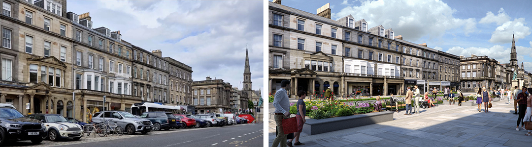
Today, George Street is dominated by cars. Traffic, clutter and parked cars block free movement for other users, as well as views of the beautiful architecture.
The proposed design creates more space on the street for walking, wheeling and cycling, and makes it easier and safer to move around.
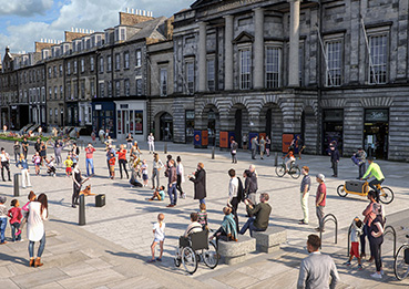
Leisure and outdoor eating spaces offer great places to rest, play, meet and enjoy the heritage and culture.
The landscaped seating areas are flexible spaces which could host pop up street art, exhibitions or appropriately scaled events.
George Street today and the same view after construction
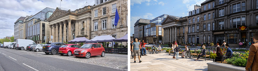
View across George Street to the Dome, today and after construction
Key considerations
- Increase the existing space available for walking, wheeling and cycling
- Provide a safe, attractive cycle route which links to the City Centre East West Link and Meadows to George Street active travel routes
- Retain blue badge parking on George Street and the First New Town streets
- Remove general parking on George Street
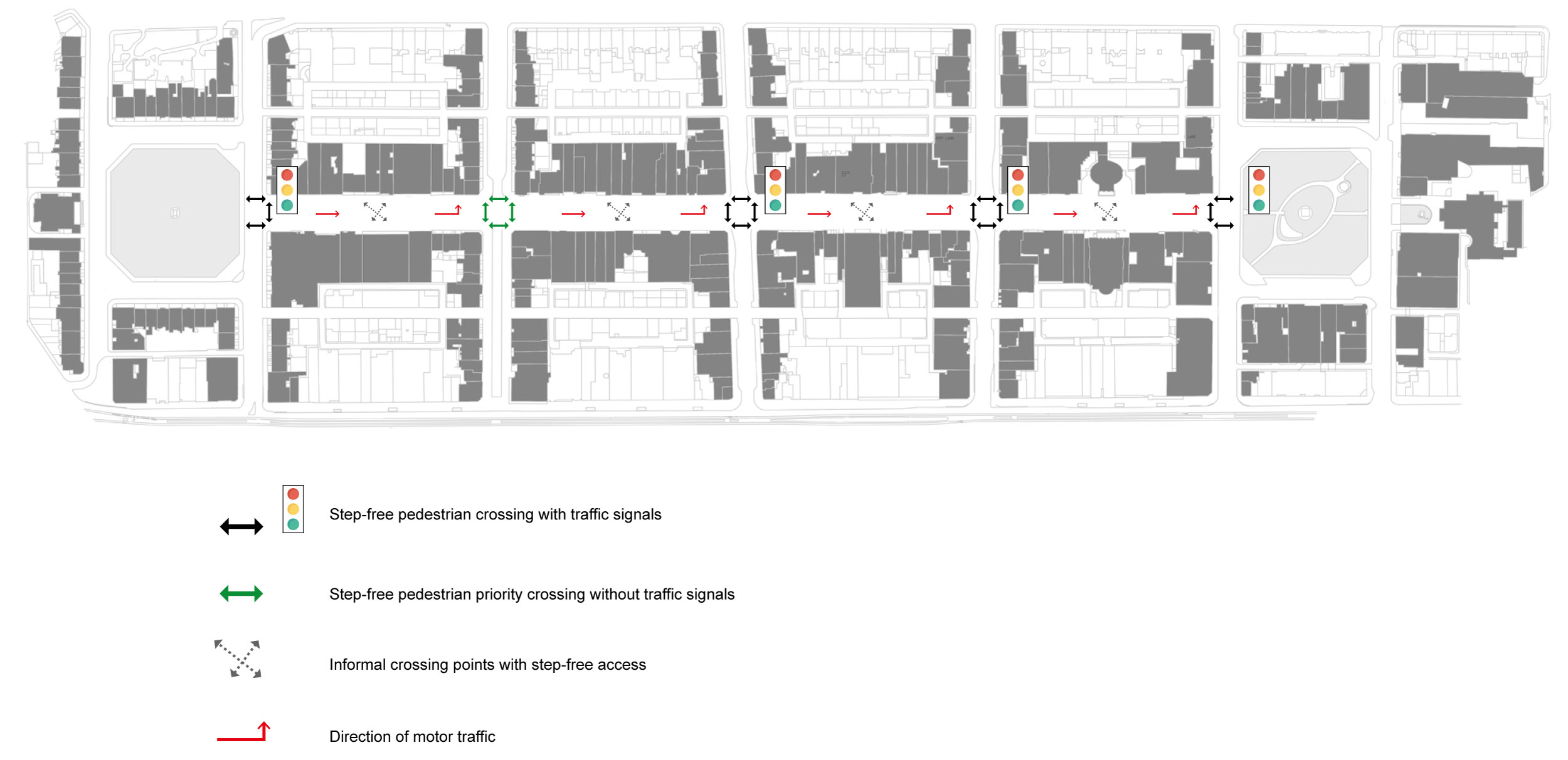
- Improve the safety and ease of crossing streets and junctions for pedestrians and cyclists
- Introduce seating areas, which will add life to the street and encourage people to spend more time there
- Preserve the historical and cultural significance of the area, ensuring that the integrity and urban form are maintained, including careful consideration of materials
- Prioritise access for people of all abilities including those with sensory and mobility impairments
- Give careful consideration to bus users on Frederick and Hanover Street
- Give careful consideration to residents parking, retaining this on Castle Street and Frederick Street.
Accessibility
As well as encouraging more walking and cycling, the proposal has been designed for the needs of anyone with a disability.
Disabled parking bays are provided along the length of George Street and are also located in surrounding interconnected streets.
There will also be several informal crossing points within each block, and with a narrower central street, the opportunity to walk along and across will be much improved.
 Flexible space
The design is flexible and will accommodate a variety of needs at various times of the day, week and year. Appropriately scaled events can still be accommodated while balancing the needs of others.
Key considerations
- Create an adaptable design that caters for a range of appropriately scaled events, whilst retaining clear access for walking, cycling and wheeling
- Address the need for infrastructure such as power and water into the design to minimise clutter during events
- Recognise the area as a place where residents live and need to go about their daily lives, maintaining clear and safe pedestrian and cycle routes during events.
Pavements
No pavement will be less than 4 metres wide, varying occasionally to fit with the building lines.
Spill-out zones
Cafes and restaurants can use the area between the pavement and the buildings as a spill-out zone for seating. This will be approximately 2.5 metres wide.
Flexi-zones
A flexible space between the loading/parking zones and the pavement which can be used as a further spill-out area for businesses or for street furniture such as cycle parking and bins.